")


Now radar stations of the review of the land surface find broad application in Armed Forces and in case of the decision of different economic tasks. By means of such systems it is possible to receive images of objects, on quality the close to optical. Radar images are used by development and up-dating of topographic, situation-dependent and subject maps of different scales. Are widely applied in case of a study of vertical sagging and adjustments of the land surface during construction of facilities.
According to radar images measure heights of objects of terrain and build high-precision digital models of terrain. Besides such images are necessary when monitoring stationary and mobile objects on the Earth's surface and speed sensing of moving objects. Also radar images are necessary in case of assessment of a status of agricultural grounds, and also in educational institutions in case of a study of the disciplines connected to decryption of images.
Very often, when carrying out practical operations with cadets and listeners on decryption it is necessary to show how different objects of terrain on radar images look. Because of features of formation radar images have a row of differences from optical.
The present radar images in educational process aren't enough, and there are practically no images of different objects of terrain (for example, the separate building, a boiler room, the road, channels, etc.).
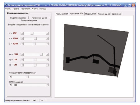
For high-quality training it is possible to model process of obtaining radar images, beginning from the moment of radiation of a radio-frequency pulse and finishing with image generation. And the model shall consider all factors influencing quality of the received radar images.
The program complex of the analysis and simulation of radar images developed in a software environment of Borland Delphi is described. It functions under control of the Microsoft Windows operating system.